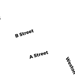
50 B STREET
Owner Information
LIPSKY DAYLE S & JONATHAN N TRS
16 MICHAEL LN
MANSFILED, MA 02048


Property Details
50 B STREET is classified as a Single Family Residential (Colonial).
The primary structure on this property was built in 1930. There are 1,840ft2 of built area within this property. There is 1,840ft2 of residential/living space within this property. This property is listed as having 6 rooms.
50 B STREET is valued at $521,100. The land is valued at $232,200 and the structures are valued at $288,600. There is an additional valuation of $300 on this property.
This property is in Zone SFA. Confirm with local Zoning Board authorities to ensure there are no overlays or other easements on this property.
The most recent deed for 50 B STREET is recorded at the local registrar in Book 55650, Page 92. 50 B STREET was last sold on Tuesday, September 14, 2021 for $100.
Assessment data from fiscal year 2022.
Flood Data
This property is completely within the AE Zone (within floodplain).
The base flood elevation for this flood zone is 10 feet.
This information is sourced from the FEMA National Flood Hazard Layer. See our full disclamer.
Broadband Internet Providers
| Provider | Type | Bandwidth (mbps) | |
|---|---|---|---|
| HughesNet | Satellite | 25 | 3 |
| VSAT Systems, LLC. | Satellite | 2 | 1 |
| Viasat Inc | Satellite | 100 | 3 |
| Verizon New England Inc. | Fiber | 940 | 880 |
| Comcast | Cable | 1000 | 35 |
| GCI Communication Corp. | Satellite | 0 | 0 |
| Verizon New England Inc. | DSL | 10 | 1 |
Broadband service provider data from December 2020.
Adjacent Properties
- 48 B STREET
Single Family Residential owned by HORNE LOUISE R - 49 A STREET
Two-Family Residential owned by HARVEY TIMOTHY - 53 A STREET
Single Family Residential owned by CHIBA JEREMY M & TERESA TRS - 51 A STREET
Single Family Residential owned by CROWELL ROBERT W & JANE E TRS - 52 B STREET
Single Family Residential owned by ADOLPH CAROL A